


Spring Creek Precinct, Johnson County, Nebraska
About
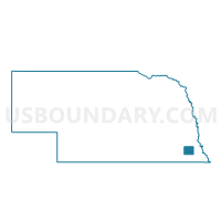
Outline

Summary
| Unique Area Identifier | 613298 |
| Name | Spring Creek Precinct |
| County | Johnson County |
| State | Nebraska |
| Area (square miles) | 53.67 |
| Land Area (square miles) | 53.49 |
| Water Area (square miles) | 0.18 |
| % of Land Area | 99.67 |
| % of Water Area | 0.33 |
| Latitude of the Internal Point | 40.47393630 |
| Longtitude of the Internal Point | -96.15228020 |
Maps


Graphs
Select a template below for downloading or customizing gragh for Spring Creek Precinct, Johnson County, Nebraska


Neighbors
Neighoring Voting District (by Name) Neighboring Voting District on the Map
- Lafayette Precinct, Nemaha County, NE
- McWilliams Precinct, Otoe County, NE
- Nemaha Precinct 2, Johnson County, NE
- So. Branch Precinct, Otoe County, NE
- Sterling Precinct, Johnson County, NE
- Washington Precinct, Nemaha County, NE
Top 10 Neighboring County Subdivision (by Population) Neighboring County Subdivision on the Map
- Nemaha precinct, Johnson County, NE (1,132)
- Washington precinct, Nemaha County, NE (716)
- Spring Creek precinct, Johnson County, NE (542)
- McWilliams precinct, Otoe County, NE (450)
- Lafayette precinct, Nemaha County, NE (305)
- Helena precinct, Johnson County, NE (231)
- Osage precinct, Otoe County, NE (213)
- South Branch precinct, Otoe County, NE (208)
- Lincoln precinct, Johnson County, NE (147)
Top 10 Neighboring Place (by Population) Neighboring Place on the Map
Top 10 Neighboring Unified School District (by Population) Neighboring Unified School District on the Map
- Johnson County Central Public Schools, NE (4,584)
- Sterling Public Schools, NE (1,386)
- Johnson-Brock Public Schools, NE (1,347)
Top 10 Neighboring State Legislative District Upper Chamber (by Population) Neighboring State Legislative District Upper Chamber on the Map
Top 10 Neighboring 111th Congressional District (by Population) Neighboring 111th Congressional District on the Map
Top 10 Neighboring Census Tract (by Population) Neighboring Census Tract on the Map
- Census Tract 9681, Nemaha County, NE (3,595)
- Census Tract 9667, Otoe County, NE (3,113)
- Census Tract 9668, Otoe County, NE (2,893)
- Census Tract 9666, Otoe County, NE (2,128)
- Census Tract 9675, Johnson County, NE (2,011)
Top 10 Neighboring 5-Digit ZIP Code Tabulation Area (by Population) Neighboring 5-Digit ZIP Code Tabulation Area on the Map
- 68450, NE (3,182)
- 68443, NE (1,047)
- 68378, NE (680)
- 68329, NE (673)
- 68448, NE (399)
- 68320, NE (369)
- 68324, NE (174)